Please ensure that you read through our disclaimer before using IntraMaps. Use of our GIS service is subject to your acceptance of the disclaimer.
About our GIS viewer
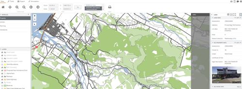
IntraMaps is a public mapping application that uses a GIS (Geographic Information System) to enable you to view property and land information, networked services, the District Plan, aerial photography and other data for the Westland District.
IntraMaps is easy to navigate and has some extremely useful features that will continue to be developed. With it you can:
- Search for property and rates information,
- See the latest aerial photography,
- Find the location of council-owned water, wastewater and storm water pipes,
- View building and resource consent information,
- Search for cemetery plot images and records,
- See what day your rubbish is collected,
- Find the closest council reserve and;
- View District Plan information.
GIS data and mapping services
If you require any mapping products or are looking to acquire the data available in our GIS viewer, please contact our GIS team.
Retrolens
Retrolens is a resource for decision making, complying with regulatory requirements and cultural heritage. Retrolens is a collaboration between a number of councils and central government to preserve and digitise more than 500,000 historic aerial photo negatives, dating back to the 1930s.
The images are available for download and released under Creative Commons Attribution 3.0 NZ.
Contact us
We would like to hear your feedback on our GIS viewer. This includes any bugs, suggestions you have for new functionality, or data that you think should be available to the public - email us.
You may also be interested in
